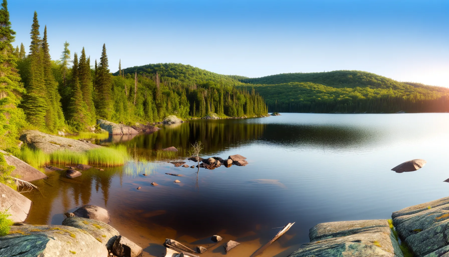
Fishing at Lac Carillon, Notre-Dame-de-Montauban
Lac · Mauricie
Notre-Dame-de-Montauban
Sponsored
Partners


Description
Lake Carillon in Notre-Dame-de-Montauban is a popular spot for fishing for smallmouth bass and brook trout. With its accessible boat launch, it's easy to enjoy a day of fishing in nature. Whether for a summer outing or an ice fishing experience, this lake will charm you.
Highlights
- 🎣SpeciesSmallmouth bass and brook trout
- 📍LocationLake Carillon, Notre-Dame-de-Montauban
- 🚤Access/LaunchAccessible boat launch
- 📅SeasonSummer outings and ice fishing
Onsite Equipment
Réglementation officielle
Zone de pêche, exceptions et règles MFFP / Québec.ca
Nouveautés réglementaires de la zone
- des Outaouais (Lac des Deux Montagnes) a) That part between the Carillon dam (45°34'2,29" N., 74°23'02" W.) and the electrical power transmission line situated about 4 km downstream from that dam (45°32'19'' N, 74°21'08'' W)Rivière
- des Outaouais (Lac des Deux Montagnes) f) That part made up of Carillon Bay, north of the straight line that links Roches Point (45°31'27" N, 74°18'42" W) at Pointe au Foin (45°31'25.06" N, 74°19'18.48" W)Rivière
- des Outaouais (Lac des Deux Montagnes) g) That part made up of Fer à Cheval Bay west of the straight line that links the eastern tip of Carillon island (45°30'59" N, 74°15'05" W) to the eastern tip of Île à Paquin (45°30'43'' N, 74°15'51'' W)Rivière
- des Outaouais (Lac des Deux Montagnes) c) That part between the electric power transmission line located approximately 4 km downstream of the Carillon Dam (45°32'19" N., 74°21'08" W.) and the downstream limits of Lake of Two Mountains, namely: (1) the Highway 40 bridge (45°25'12.92" N., 73°59'01.92" W.); (2) the upstream portion of the Rivière des Prairies (45°28'24.32" N., 73°56'25.32" W. and 45°31'17.26" N., 73°52'50.79" W.); (3) the upstream portion of the Rivière des Mille Îles (45°31'49.53" N., 73°53'15.75" W.), including the downstream section of the Rigaud River up to the Highway 40 bridge (45°29'10" N., 74°17'57" W.)RivièreNouveau 2026Zone 8 →
- of the Morelle (Saint-Ubalde) (46°48'45" N., 72°10'44" O.)HiverZone 27 →
Source : peche.faune.gouv.qc.ca — vérifie toujours les règles officielles avant de pêcher.
Guide de consommation
Mercure (Hg) et nombre de repas/mois autorisés selon la taille — données MELCCFP officielles.
| Espèce | Petit | Moyen | Gros | Statut |
|---|---|---|---|---|
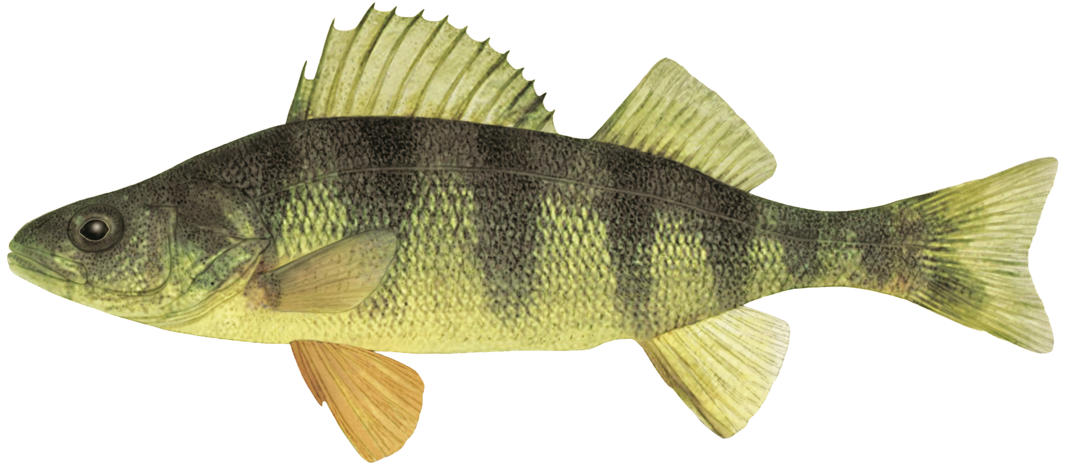 Perchaude Perchaude | 15-20cm 8 repas/mois Hg 0.3 mg/kg | 20-25cm 4 repas/mois Hg 0.71 mg/kg | ≥25cm 2 repas/mois Hg 1.56 mg/kg | ✓ Autorisé |
Recommandations pour enfants, femmes enceintes et qui allaitent
À éviter : Pour les jeunes enfants, les femmes qui planifient une grossesse, les femmes enceintes et celles qui allaitent, il est recommandé de consommer cette espèce de poisson de manière occasionnelle seulemen
À réduire : Pour les femmes qui planifient une grossesse, les femmes enceintes et celles qui allaitent, il est recommandé de réduire de moitié le nombre de repas par mois.
1 repas = 230 g (8 oz) de poisson avant sa cuisson. Le nombre total de repas doit être ajusté en fonction de toutes les espèces consommées durant le mois.
Source : Guide de consommation MELCCFP (CC-BY 4.0). 1 repas = portion 230g (8oz) avant cuisson.