
Back to the map Rivière0.6 kmRivière0.6 km
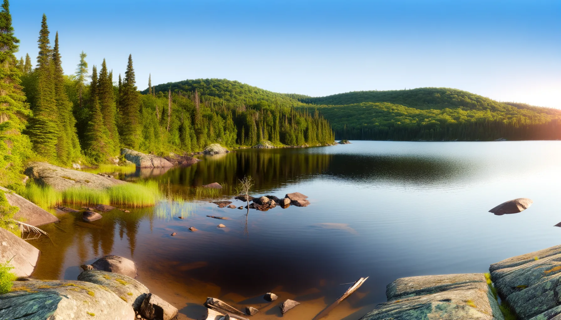 Lac2.5 kmLac6.2 kmLac6.2 kmLac6.6 kmRivière10.6 kmRivière11.3 km
Fishing at Rivière Jacques-Cartier, Sainte-Catherine-de-la-Jacques-Cartier
Rivière · Capitale-Nationale
RivièreEasy access
Sainte-Catherine-de-la-Jacques-Cartier
Sponsored
Partners


Description
The Jacques-Cartier River in Sainte-Catherine-de-la-Jacques-Cartier is a beautiful spot for fishing for brook trout and smallmouth bass. With parking and a boat launch available, it's easy to access this ideal spot for your next fishing trip. Get your rods ready and come enjoy the tranquility of nature!
Highlights
- 🎣SpeciesBrook trout and smallmouth bass.
- 📍LocationJacques-Cartier River, Sainte-Catherine.
- 🚤Access/LaunchParking and boat launch available.
- 🌊Water bodyPerfect for a peaceful fishing trip.
Onsite Equipment
Boat Launch
Parking
Réglementation officielle
Zone de pêche, exceptions et règles MFFP / Québec.ca
Nouveautés réglementaires de la zone
Modification of daily catch limit for char: 10 in all, with a maximum of 2 Arctic char.
Complete closure of landlocked salmon fishing in rivière Montmorency from the base of chute Montmorency to the north side of the route 138 right-of-way.
Modification of Atlantic salmon fishing season in the rivière Malbaie between the downstream side of the route 138 bridge and the downstream side of the railway crossing in Clermont: advanced to June 1.
Modification of the fishing season for all species except striped bass and Atlantic salmon in rivière Petit Saguenay between the mouth of the river and the bridge on chemin des Chutes: closes September 15.
Modification of the daily catch limit for Atlantic salmon in rivière Petit Saguenay between the mouth of the river and the bridge on chemin des Chutes: 0 retained and no more than 3 caught and released.
Exceptions réglementaires sur ce plan d'eau
- Jacques-CartierRivièreSaumonZone 27 →
- de la rivière Jacques-CartierEauxSaumonZone 27 →
- de la rivière Jacques-CartierEaux
- between the downstream side of Pierre-Laporte bridge and a line joining a point situated 50 m downstream of Batiscan wharf on the north shore (46°30'03" N., 72°14'44" W.), and a point situated 50 m downstream of Saint-Pierre-les-Becquets wharf on the south shore (46°30'28" N., 72°12'19" W.), as well as the parts of rivers situated between highways 132 and 138. * Note : The following rivers are part of fleuve Saint-Laurent: Bélisle and Grand Bras, downstream of the Highway 138 bridge; Cap Rouge, downstream of the Rue Saint-Félix bridge; Jacques-Cartier and Portneuf, downstream of the CN bridge.HiverZone 7 →
- OntaritziRivièreSaumonZone 27 →
Source : peche.faune.gouv.qc.ca — vérifie toujours les règles officielles avant de pêcher.
Location
Other fishing spots nearby
8Rivière0.6 kmSainte-Catherine-de-la-Jacques-Cartier (repère)
Rivière0.6 kmRivière Jacques-Cartier
Sainte-Catherine-de-la-Jacques-Cartier
Lac2.5 kmLac Saint-Joseph
Sainte-Catherine-de-la-Jacques-Cartier
Lac6.2 kmLac Saint-Joseph
Sainte-Catherine-de-la-Jacques-Cartier
Lac6.2 kmLac Saint-Joseph
Fossambault-sur-le-Lac
Lac6.6 kmLac Saint-Joseph
Fossambault-sur-le-Lac
Rivière10.6 kmRivière Jacques-Cartier
Pont-Rouge
Rivière11.3 kmRivière Jacques-Cartier
Pont-Rouge