Zone 17 fishing in Quebec
MFFP 2026 regulations, limits, opening dates & exceptions
40
Exceptions
0
2026 novelties
0
Winter fishing
0
Salmon rivers
Zone map
Fish species in Zone 17
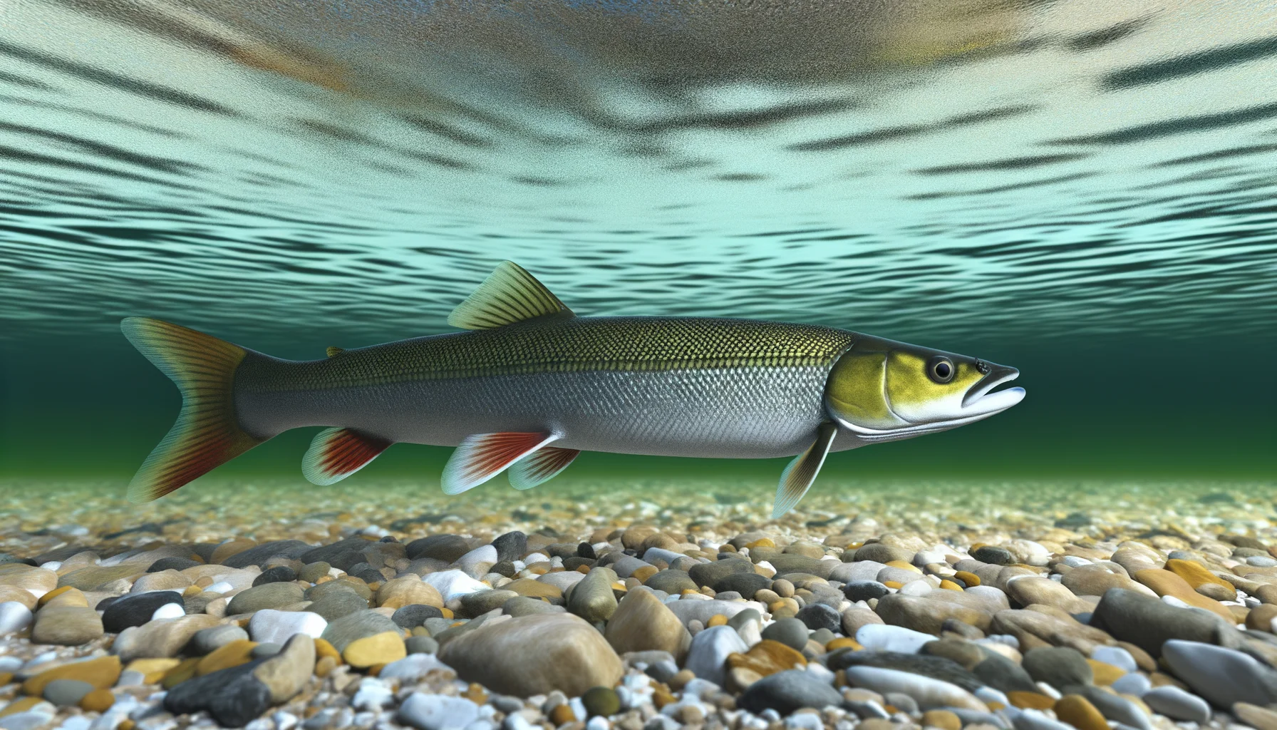

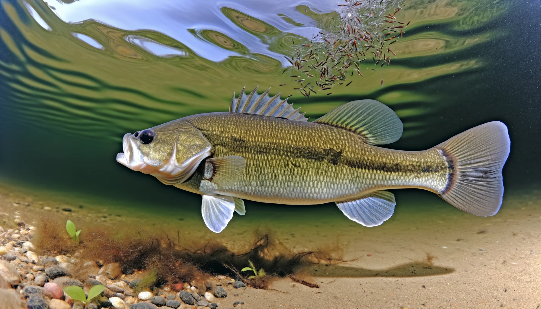


→ Tap a species for habitat, baits, techniques and seasons.
Complete zone rules
Zone 18
Fishing zones :
- Fishing zones 1
- Fishing zones 2
- Fishing zones 3
- Fishing zones 4
- Fishing zones 5
- Fishing zones 6
- Fishing zones 7
- Fishing zones 8
- Fishing zones 9
- Fishing zones 10
- Fishing zones 11
- Fishing zones 12
- Fishing zones 13
- Fishing zones 14
- Fishing zones 15
- Fishing zones 16
- Fishing zones 17
- Fishing zones 18
- Fishing zones 19
- Fishing zones 20
- Fishing zones 21
- Fishing zones 22
- Fishing zones 23
- Fishing zones 24
- Fishing zones 25
- Fishing zones 26
- Fishing zones 27
- Fishing zones 28
- Fishing zones 29
Zone 18
New rules
New rules have been in effect in this zone since April 1, 2026. See the latest changes the latest changes.
On this page:
Maps
Interactive map of fishing zones
Fishing periods and quotas
The opening and closing dates and catch limits may vary from one body of water to another in the same area. You should always check to see if your body of water is a regulatory exception.
**Zone's fishing periods, limits and exceptions (PDF)
Printable version.
Length limits for some species
It is prohibited to catch and keep or have in your possession a fish from the waters specified that does not comply with the length limits indicated for your zone. If a fish species or a zone is not mentioned in the table, no length limit applies to the species in this zone.
The fish must be kept in a state allowing its identification.
Striped bass
May keep Striped bass measuring between 50 cm and 65 cm inclusively where fishing for this species is permitted
State of fish Whole or gutted
Lake trout (including splake trout)
May keepLake trout of 45 cm or more
ExceptionMay keep lake trout of 55 cm or more in certain bodies of water.
May keep lake trout of less than 60 cm in Lac Fléché.
State of fishWhole or gutted, only where a length limit applies. Elsewhere, lake trout may be whole or filleted. It must be possible to count and identify the fish (a piece of skin must adhere to the filet).
Note These measurements do not apply in national parks, wildlife reserves, controlled harvesting zones (ZECs) and on certain water bodies located in the territories of a number of outfitting operation with exclusive rights.
Use of dead bait fish
Possession and use of dead bait fish is prohibited in this zone.
From December 1 to April 15, there may be possession of dead bait fish between parts of autoroutes 20 and 40 and routes 132 and 138, located in zones 1, 2, 3, 18, 19 and 27, and for use in zones 7 and 21.
Use the map of fishing zones to visualize this information by displaying the “Bait Fish” layer.
Number of lines authorized in winter
5 lines on a body of water covered with ice or not, from December 1st to April 15
Printable version of zone 18 (PDF)
Length limits, bait fish allowed and number of lines authorized in winter.
Biodiversity, Wildlife and Parks – Client Services
Monday, Tuesday, Thursday and Friday: from 8:30 a.m. to 12 p.m. and from 1 p.m. to 4:30 p.m.
Wednesday: from 10 a.m. to 12 p.m. and from 1 p.m. to 4:30 p.m.
Regulatory information:
renseignements.faune@environnement.gouv.qc.ca
See also
How to measure and fillet fish
Imported from quebec.ca · 5/1/2026
Periods and catch limits — Zone 17
Official rules from the Government of Quebec, reproduced word for word. Search by species, period or limit.
Always check the official tool before fishing. The government publishes in-season changes, and limits inside structured wildlife territories (zecs, réserves, outfitters) may differ.
Data retrieved on October 20, 2026.
14 rules
- Brochets
Du 1 er avril 2026 au 23 avril 2026
8 en tout
Pêche à la ligne seulement
- Doré jaune et doré noir
Du 1 er avril 2026 au 23 avril 2026
8 en tout
Length limit : Doré jaune: 37 cm à 53 cm inclusivement et au plus 1 mesurant 53 cm et plus Doré noir: Aucune limite de longueur
Pêche à la ligne seulement
- Perchaude
Du 1 er avril 2026 au 23 avril 2026
50
Pêche à la ligne seulement
- Bar rayé
Du 1 er avril 2026 au 31 mars 2027
Pêche interdite
- Chevalier cuivré
Du 1 er avril 2026 au 31 mars 2027
Pêche interdite
- Ombles (omble de fontaine, omble chevalier)
Du 24 avril 2026 au 7 septembre 2026
15 en tout ou 4 kg + 1 omble selon la première limite atteinte
Pêche à la ligne seulement
- Touladi, moulac et lacmou
Du 24 avril 2026 au 7 septembre 2026
1 en tout
Length limit : 55 cm et plus
Pêche à la ligne seulement
Dans les eaux comprises à l'intérieur des territoires particuliers: 2 en tout
- Corégones
Du 22 mai 2026 au 7 septembre 2026
aucune limite
Pêche à la ligne seulement
- Brochets
Du 22 mai 2026 au 31 mars 2027
8 en tout
Pêche à la ligne seulement
- Doré jaune et doré noir
Du 22 mai 2026 au 31 mars 2027
8 en tout
Length limit : Doré jaune: 37 cm à 53 cm inclusivement et au plus 1 mesurant 53 cm et plus Doré noir: Aucune limite de longueur
Pêche à la ligne seulement
- Perchaude
Du 22 mai 2026 au 31 mars 2027
50
Pêche à la ligne seulement
- Esturgeons
Du 15 juin 2026 au 31 octobre 2026
1 en tout
Pêche à la ligne seulement
- Autres espèces
Du 1 er avril 2026 au 23 avril 2026 - Autres espèces
aucune limite
Pêche à la ligne seulement
- Autres espèces
Du 22 mai 2026 au 31 mars 2027 - Autres espèces
aucune limite
Pêche à la ligne seulement
32 water bodies with their own rules— tap to see the list
These water bodies have limits that differ from the zone. Their detail is in the official tool and in the full PDF above.
- Lac Antoinette ( 49°56'00" N., 74°25'37" O. )
- Lac au Goéland la partie comprise dans un rayon de 200 m en amont de l'embouchure de son émissaire, la rivière Waswanipi délimitée par les coordonnées 49°50'19" N., 76°54'53" O. et 49°50'29" N., 76°54'38" O.
- Lac aux Dorés ( 49°51'09" N., 74°21'05" O. )
- Lac Bourbeau - ( 49°57'37" N., 74°17'33" O. )
- Lac Caché ( 49°50'15" N., 74°24'15" O. )
- Lac Chevrier (Lac Obatogamau) entre un point situé à 49°38'50" N., 74°26'18" O. et l'embouchure du ruisseau Audet ( 49°38'44" N., 74°24'01" O. ).
- Lac Chibougamau - à l'exception des secteurs suivants: baie du Club ( 49°53'22" N., 74°01'50" O. ); baie Girard, la partie comprise dans un rayon de 500 m en aval de l'embouchure de la rivière Armitage ( 49°52'05" N, 74°03'20" O. ); baie Nepton, la partie comprise dans un rayon de 500 m en aval de l'embouchure de la rivière Nepton ( 49°55'09" N., 74°00'57" O. ) ainsi que la partie comprise dans un rayon de 500 m en aval de l'embouchure de la Petite rivière Nepton ( 49°55'26" N., 74°01'48.2" O. ); rivière Armitage entre son embouchure dans la baie Girard et un point située à 5 km en amont ( 49°49'40" N. 74°05'10" O. ); rivière Nepton entre son embouchure dans la baie Nepton et un point situé à 2 km en amont ( 49°55'30" N., 74°00'30" O. ); rivière Petite rivière Nepton entre son embouchure dans la baie Nepton et un point situé à 1 km en amont ( 49°55'40" N., 74°01'50" O. ); rivière Énard, la partie comprise entre son embouchure dans la baie Inlet et un point situé à 7 km en amont ( 49°42'30" N., 74°20'49" O. )
- Lac Chibougamau - Baie du Club ( 49°53'22" N., 74°01'50" O. )
- Lac Chibougamau - Baie Girard, la partie comprise dans un rayon de 500 m en aval de l'embouchure de la rivière Armitage ( 49°52'05'' N., 74°03'20'' O. )
- Lac Chibougamau - Baie Nepton, la partie comprise dans un rayon de 500 m en aval de l'embouchure de la Petite rivière Nepton ( 49°55'26'' N., 74°01'48.2'' O. ) ainsi que la partie comprise dans un rayon de 500 m en aval de l'embouchure de la rivière Nepton ( 49°55'09'' N., 74°00'57'' W. )
- Lac Chibougamau - Petite rivière Nepton, entre son embouchure dans la baie Nepton et un point situé à 1 km en amont ( 49°55'40'' N., 74°01'34,6'' O. )
- Lac Chibougamau - Rivière Armitage, entre son embouchure dans la baie Girard et un point situé à 5 km en amont ( 49°49'40'' N., 74°05'10'' O. )
- Lac Chibougamau - Rivière Énard, la partie comprise entre son embouchure dans la baie Inlet et un point situé à 7 km en amont ( 49°42'30" N., 74°20'49" O. )
- Lac Chibougamau - Rivière Nepton, entre son embouchure dans la baie Nepton et un point situé à 2 km en amont ( 49°55'30'' N., 74°00'30'' O. )
- Lac Doda la partie comprise dans un rayon de 500 m de l'embouchure de la rivière Saint-Cyr ( 49°19'03" N., 75°19'13" O. ).
- Lac Father - ( 49°18'41" N., 75°28'26" O. )
- Lac Lymburner ( 49°57'24" N., 74°03'55" O. )
- Lac Matagami ( 49°52'00" N., 77°26'47" O. )
- Lac Pusticamica la partie comprise dans un rayon de 300 m en aval de l'embouchure de la rivière O'Sullivan délimitée par les coordonnées 49°20'41" N., 76°20'32" O. et 49°20'44" N., 76°20'33" O.
- Lac Waswanipi la partie comprise dans un rayon de 300 m en aval de l'embouchure de la rivière O'Sullivan ( 49°27'59" N., 76°28'05" O. et 49°27'55" N., 76°28'06" O. ) (cantons Ailly, Bosse et Nelligan).
- Rivière Chibougamau entre le pont du Rapide entre les îles (route 48211, km 14) ( 49°54'04" N., 74°44'23" O. ) et une droite située à 1,5 km en aval, vers le lac Opémisca, reliant les points 49°53'34" N., 74°45'22" O. et 49°53'31" N., 74°45'08" O. .
- Rivière de l'Aigle entre son embouchure dans le lac Doda et une droite située à 7 km en amont reliant les points 49°23'37" N., 75°07'44" O. et 49°23'27" N., 75°07'27" O. .
- Rivière Opawica entre le pont du kilomètre 37,5 du chemin R-1009 (Barrette-sud) et un point situé à 1 km en aval, vers le lac des Vents ( 49°29'45" N., 74°46'00" O. ).
- Rivière Opawica entre son embouchure dans le lac Doda et un point situé à 5 km en amont ( 49°28'30" N., 75°05'39" O. ).
- Rivière Opémisca entre son embouchure dans le lac Opémisca ( 49°57'20" N., 74°54'40" O. ) et un point situé à 8 km en amont, correspondant à 50° de latitude nord.
- Rivière O'Sullivan entre son embouchure dans le lac Pusticamica délimitée par les coordonnées 49°20'41" N., 76°20'32" O. et 49°20'44" N., 76°20'33" O. et un point situé à 3,2 km en amont ( 49°19'41" N., 76°18'51" O. ).
- Rivière O'Sullivan entre son embouchure dans le lac Waswanipi délimitée par les coordonnées 49°27'59" N., 76°28'05" O. et 49°27'55" N., 76°28'06" O. et un point situé à 300 m en amont ( 49°27'50" N., 76°27'58" O. ).
- Rivière Saint-Cyr entre le pont du km 16 du chemin R1053 (Barette sud) ( 49°17'15" N., 75°18'42" O. ) et son embouchure dans le lac Doda.
- Rivière Waswanipi entre la limite des terres de catégorie II de Waswanipi et un point situé à 100 m en aval de son embouchure dans le lac au Goéland ( 49°43' N., 76°44' O. ). Canton Vignal et Ailly
- Rivière Waswanipi entre son embouchure dans le lac au Goéland délimitée par les coordonnées 49°50'19" N., 76°54'53" O. et 49°50'29" N., 76°54'38" O. et un point situé à 3 km en aval, vers le lac Olga ( 49°50'41" N., 76°56'44" O. ).
- Rivière Waswanipi entre son embouchure dans le lac Olga déterminé par les coordonnées 49°51'26" N., 77°10'24" O. et 49°51'13" N., 77°11'01" O. et un point situé à 100 m en aval de son embouchure dans le lac Matagami et délimité par les coordonnées 49°54'26" N., 77°15'47" O. et 49°54'26" N., 77°14'47" O.
- Ruisseau Germain entre un point situé sur le lac Édith ( 49°26'11" N., 75°29'28" O. ) et son embouchure dans le lac Germain ( 49°26'52" N., 75°29'00" O. ).
Looking for one species across every zone? Search the limits by species
Recent news
- 2018-05-03
- 2018-04-03
Water bodies with regulatory exceptions
Top fishing spots in Zone 17
See more on the interactive map · /carte
Frequently asked questions
Q1.What are the fishing regulations for Zone 17 in Quebec in 2026?
Zone 17 (Zone 17) regulations are published by Quebec's Ministry of Forests, Wildlife and Parks (MFFP) in the 2026 General Fishing Order. The zone has 40 water-body specific exceptions, 0 new for 2026. See the official tool at peche.faune.gouv.qc.ca/regpec for catch limits, opening dates, and minimum sizes per species.
Q2.When does fishing season open in Zone 17 for 2026?
Opening dates vary by species: walleye typically opens 3rd Saturday of May, bass 4th Saturday of June, brook trout late April in the south to early June in the north. Check the 2026 General Order for exact dates in Zone 17.
Q3.What's the catch limit for walleye and pike in Zone 17?
Standard 2026 limits: walleye 6 per day, northern pike 6 per day. Some water bodies in Zone 17 have stricter limits — 40 exceptions are listed on this page. Refer to peche.faune.gouv.qc.ca/regpec for the exact rule on your lake.
Q4.Where can I fish in Zone 17 in Quebec?
Popular spots inside or near Zone 17 include: Amos (repère rivière), Lac à la Prèle, Lac Beauchamp, Lac Berthelot, Lac Boucane. The full interactive map with 3,600+ Quebec fishing spots is available on pecheurquebec.com/carte.
Q5.Do I need a special permit for Zone 17?
A standard MFFP fishing license is required everywhere in Quebec (~$24/year for Quebec residents). For wildlife reserves and national parks within Zone 17, you also need a daily SEPAQ access reservation. Buy online at sepaq.com.
See also
Buyer’s guides
The gear we recommend


Infolettre
Get Quebec fishing dates and updates
Season openings, regulation changes, spots and tips: an occasional email, nothing else.
Exact rules by water body
Catch limits, minimum sizes and opening dates for every lake and river in Zone 17 — official Quebec government tool.
Source: MFFP — peche.faune.gouv.qc.ca. Always verify official rules before fishing.